FieldOps by DrillOps

Field evidence, mapped.

Turn your iPhone or iPad into a field camera, tracking instrument and survey companion—built for exploration, drilling, construction and remote-site work.
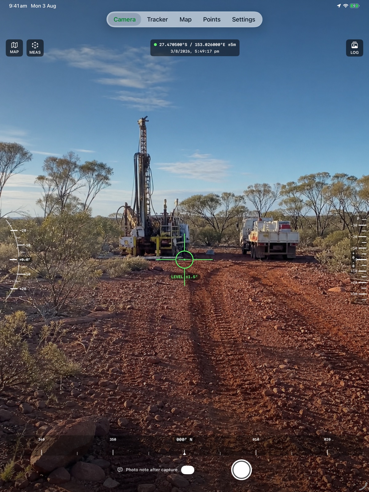
Current FieldOps camera and measuring instrument on iPad
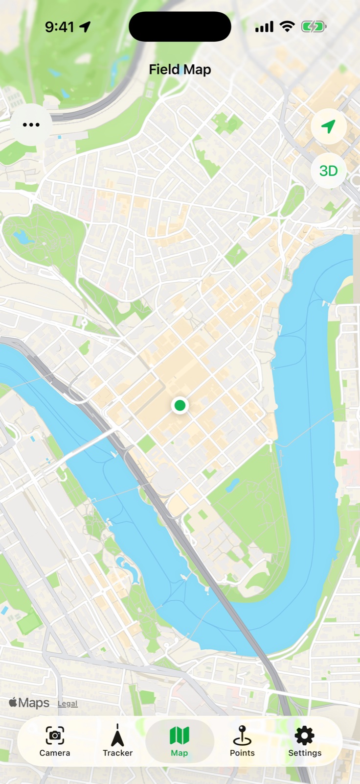
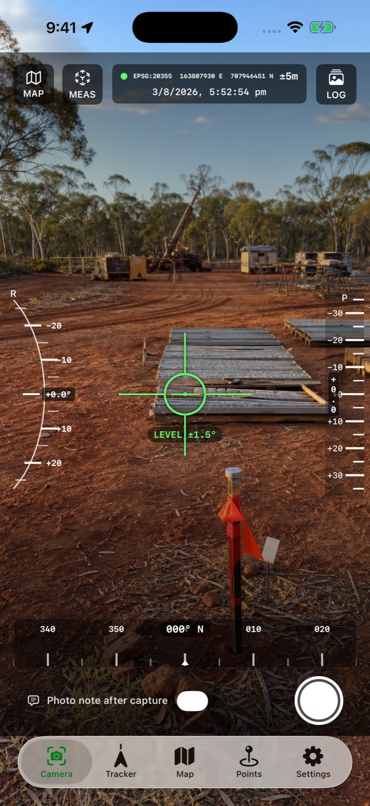
Current FieldOps map on iPhone
On-device recordsiPhone + iPadProjected coordinatesGPX · KML · CSV · DXF
A field kit in one app

Capture the place, not just the picture.

FieldOps brings location, heading, elevation, roll, timestamps and project context together so every field record is useful when the team gets back to the office.

CAM

Camera + measure

Burn instrument readings into field photographs and open AR measurement from the camera.

GPS

Track recording

Record routes and field movement, then export the data in common spatial formats.

NAV

Waypoint navigation

Create or import points and navigate with live distance, bearing and arrival guidance.

DXF

Drawing overlays

Import ASCII DXF geometry in its source coordinate system and inspect it on the map.

Made for field conditions

Move from survey plan to ground truth.

Bring the planned geometry with you, see where you are against it and capture a location-stamped record at the point of work.
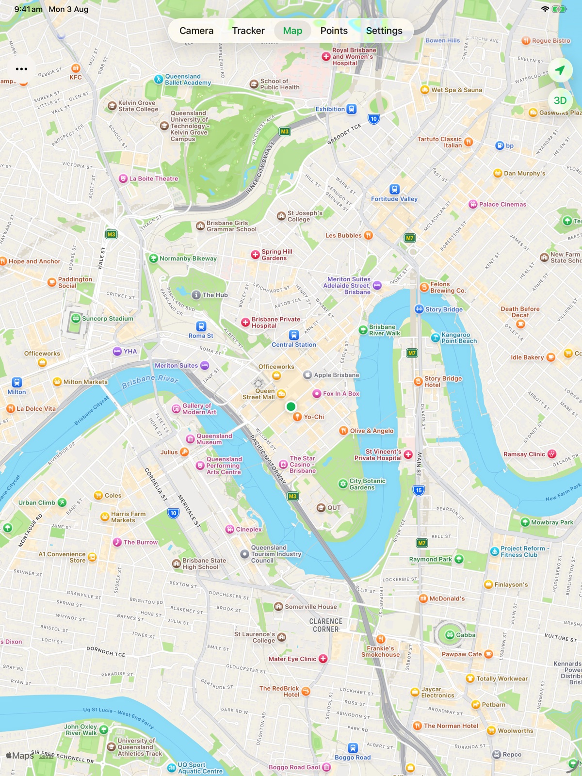
Import WGS 84, GDA2020, GDA94, AGD84 and AGD66 coordinatesWork with geographic and projected UTM, MGA and AMG gridsKeep field records on the device and under your controlExport tracks and waypoints for the rest of the project team
Current FieldOps field map on iPadCurrent FieldOps camera and measuring instrument on iPhone
One clear field workflow

Instrument, map and record.

Each view stays clear at a glance, whether you are lining up a photo, checking a drawing or documenting an observation.

01 · ORIENT

Know the direction

Read heading, pitch, roll, elevation and accuracy in one high-contrast display.

02 · DOCUMENT

Add the observation

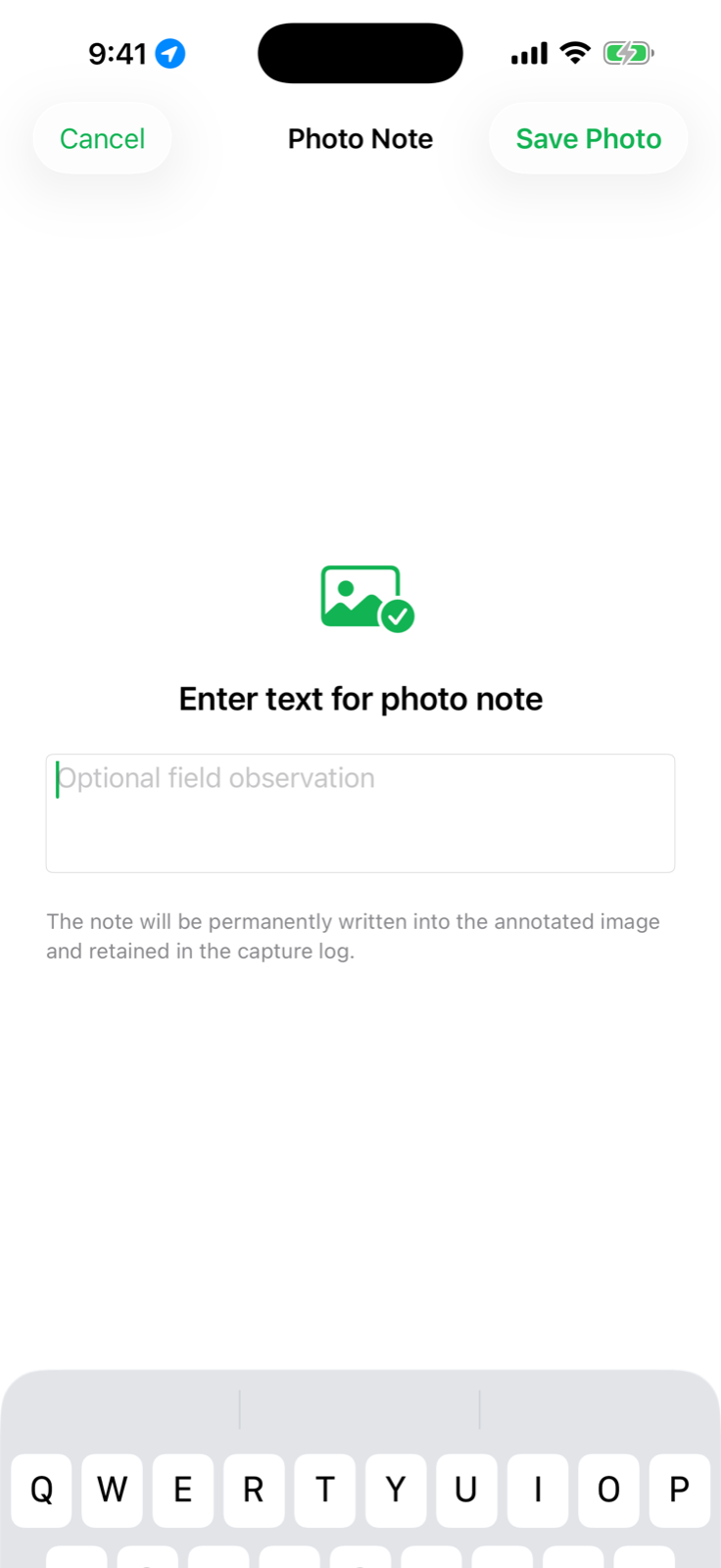
Capture a field photo and add a note so the image keeps its operational context.

03 · LOCATE

Use the right grid

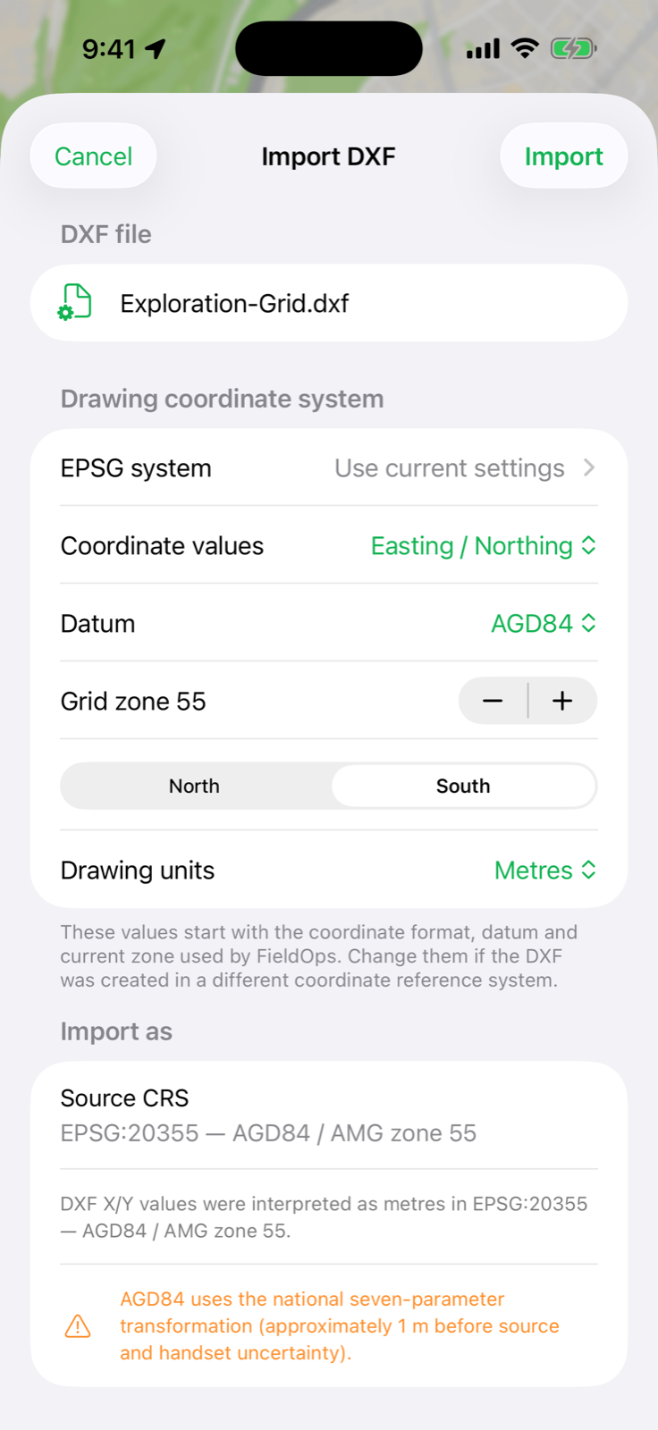
Choose the drawing datum, coordinate type, zone, hemisphere and units at import.

New · LiDAR terrain analysis

Read the ground from every angle.

Import a single-band LiDAR DTM GeoTIFF or COG and turn the original elevation cells into hillshade, an interactive 3D surface, contours and measured A–B profiles—entirely on the device.
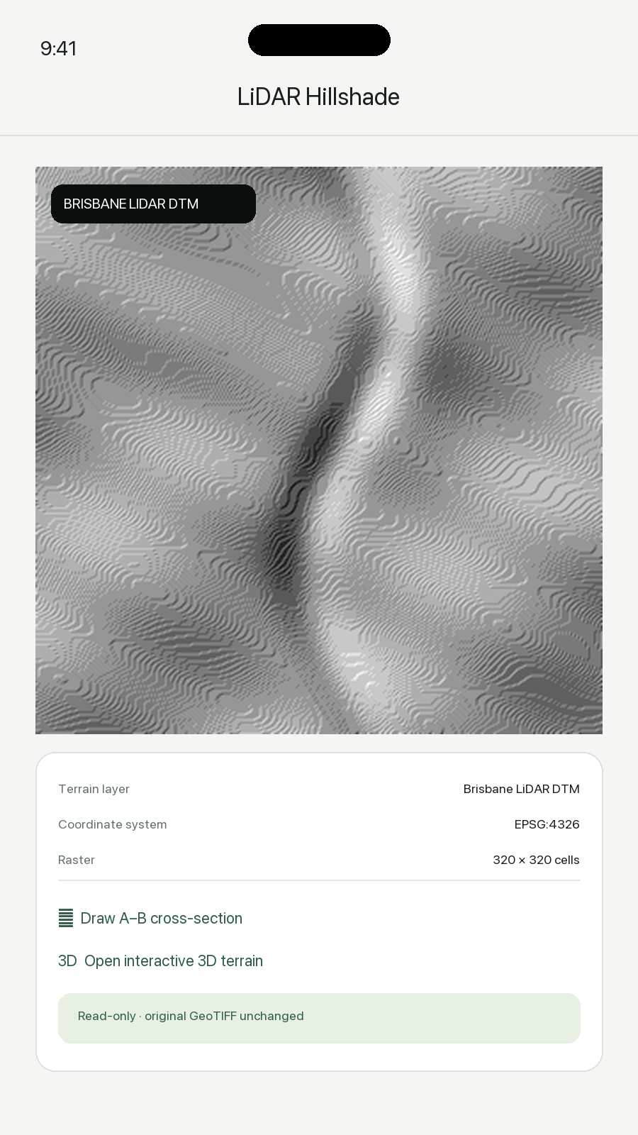
FieldOps LiDAR DTM hillshade screen
Hillshade

Make terrain readable at a glance.

FieldOps derives a shaded-relief preview from the imported elevation grid, keeps it georeferenced and places it in the same field mapping workflow as waypoints and drawings.
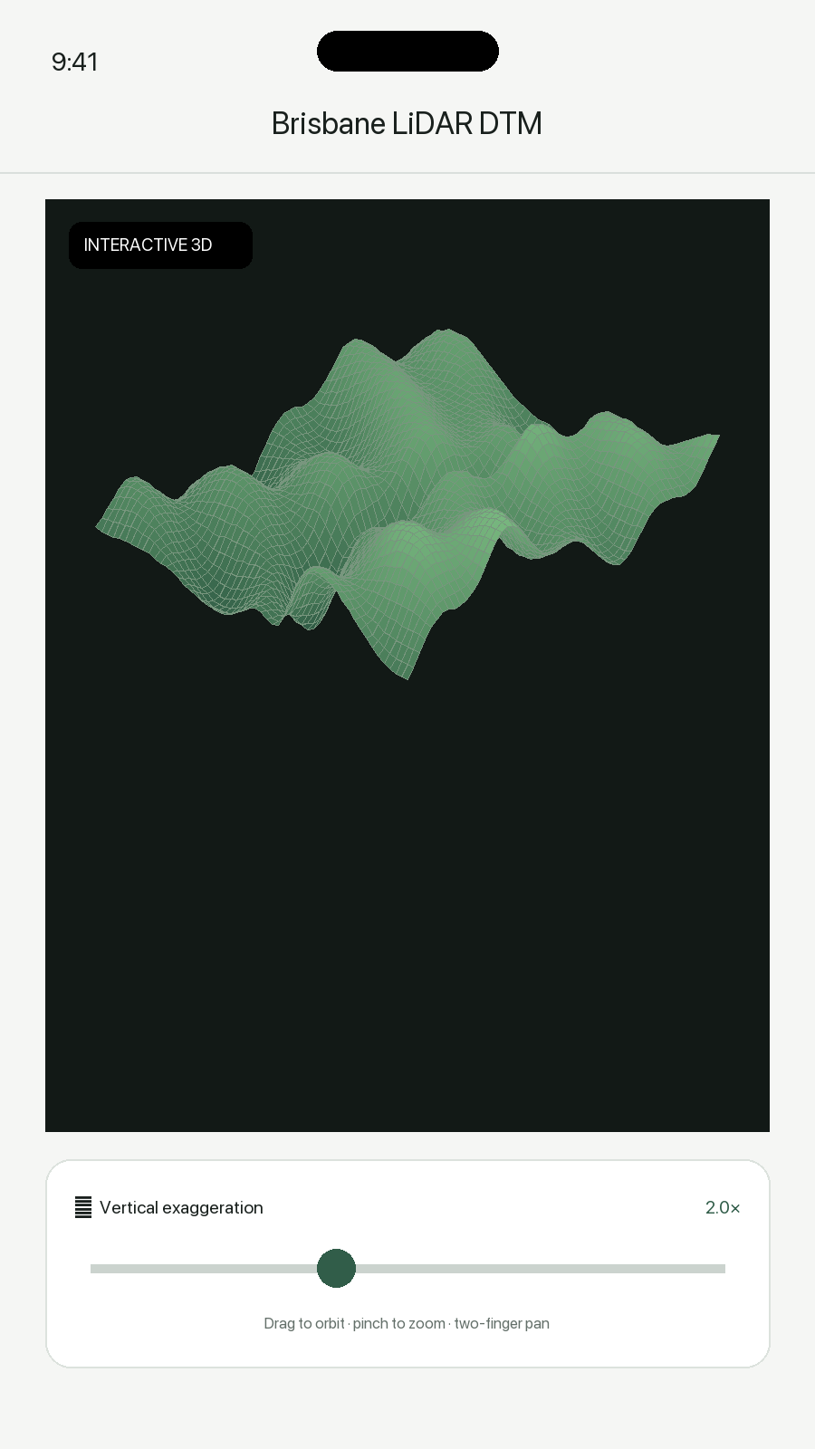
FieldOps interactive 3D terrain screen
3D terrain

Orbit the actual elevation surface.

Drag to orbit, pinch to zoom and pan across a mesh built from the selected DTM. Adjust vertical exaggeration from 0.5× to 8× to expose subtle landform changes.
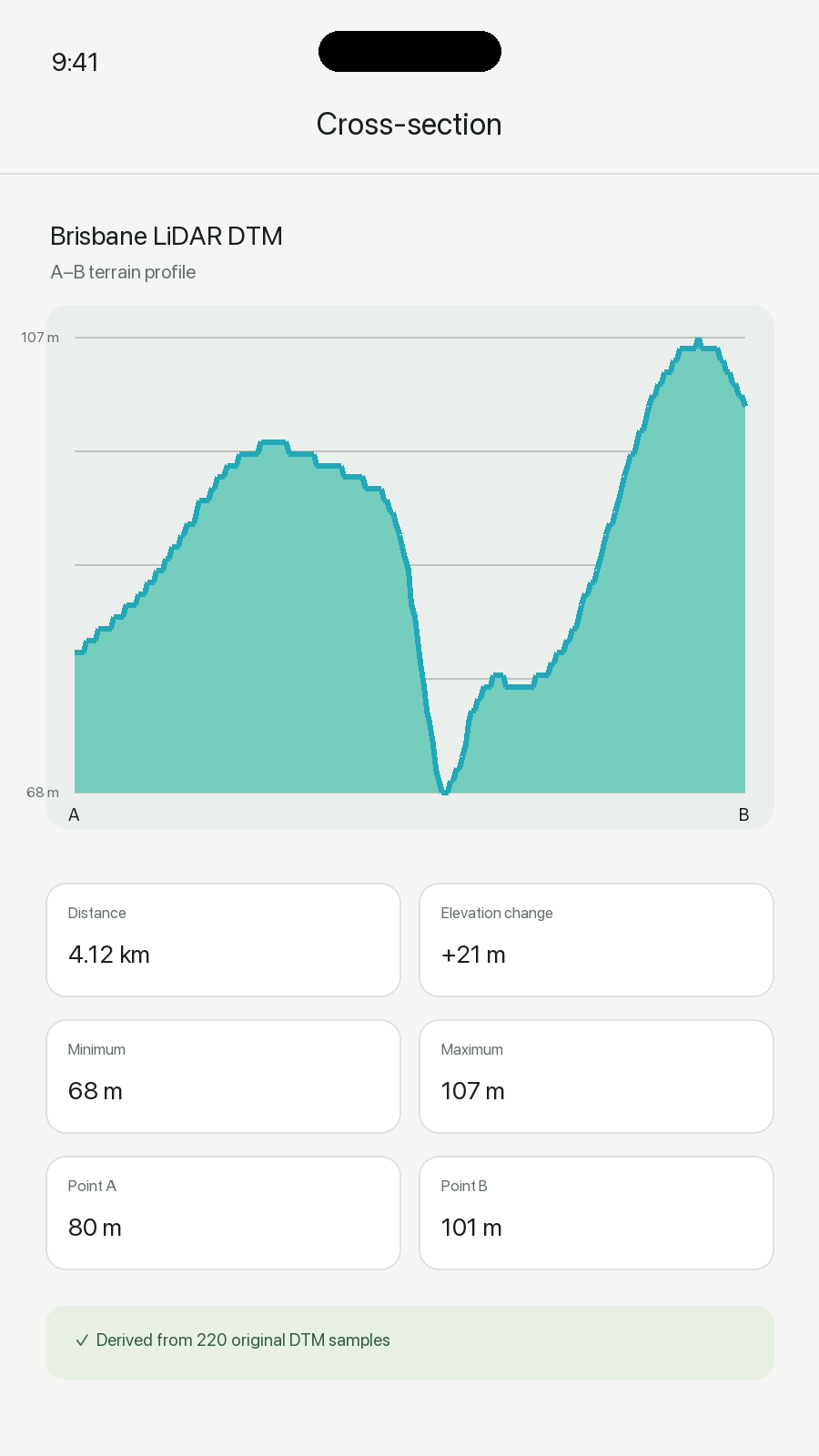
FieldOps A to B terrain cross-section screen
Cross-section

Measure the ground between two points.

Tap point A and point B to sample the original cells between them. Review distance, elevation change, minimum, maximum and both endpoint elevations.

GeoTIFF + COG importRead embedded coordinate metadata, inspect raster dimensions and confirm an EPSG system before use.
Custom contour intervalsGenerate contours at any interval greater than zero, with every fifth contour drawn heavier on the map.
On-device processingHillshade, profiles, contours and 3D meshes are derived locally for remote-site use.
Original cells sampledCross-sections use the source DTM elevation grid rather than inventing a smoothed profile.
Coordinate-aware terrainKeep terrain aligned with the project’s WGS 84, MGA, AMG and other supported EPSG workflows.
Read-only by designThe imported GeoTIFF remains unchanged; all analysis is derived and can be cleared without touching the source.
The complete FieldOps kit

Every field tool, clearly described.

The terrain suite joins the existing camera, tracking, navigation and drawing workflows in the current FieldOps experience.
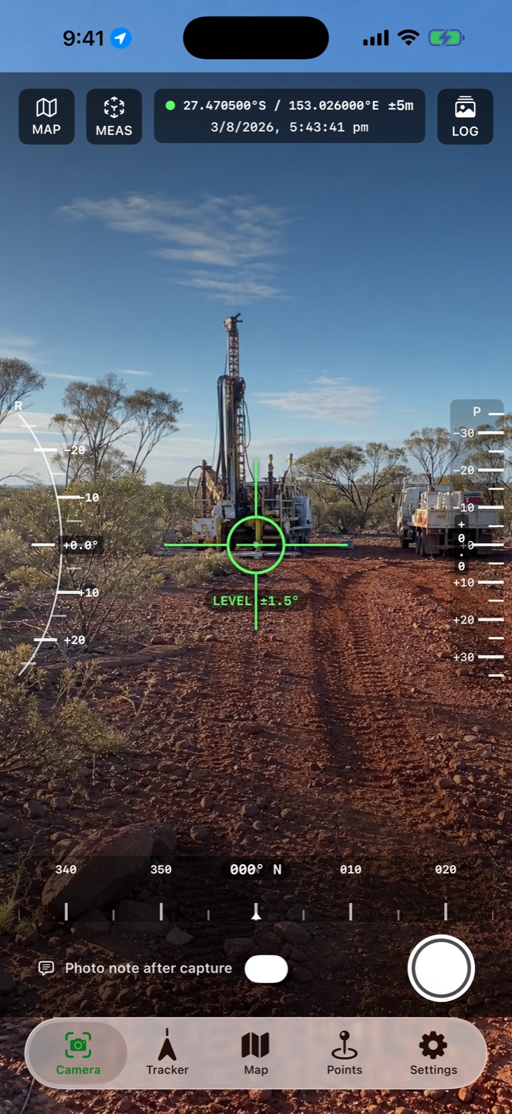
Current FieldOps live camera instrument on iPhone
Camera + AR measureCapture geotagged evidence with heading, pitch, roll, elevation, timestamp and project context; open AR measurement from the camera.
Current FieldOps photo note workflow
Photo notes + recordsAdd an observation immediately after capture and keep the image tied to its field context.
Current FieldOps coordinate-aware DXF import
Coordinate-aware importBring ASCII DXF geometry in using its source datum, EPSG code, zone, hemisphere and units.
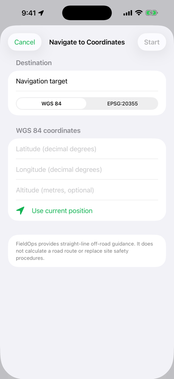
Current FieldOps coordinate navigation entry screen
Waypoints + navigationCreate or import targets, then follow live distance, bearing and arrival guidance in geographic or projected coordinates.
GPX tracks + pointsKML field recordsCSV waypoint importASCII DXF overlaysGeoTIFF / COG terrainEPSG coordinate systemsOffline track recordingOn-device field records
FieldOps for iOS and iPadOS

Take better field context with you.

FieldOps is prepared for Apple devices. For release availability, setup guidance or coordinate-system questions, visit FieldOps Support.

Visit FieldOps Support